
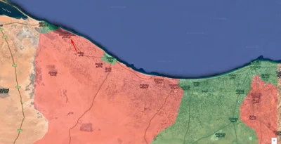
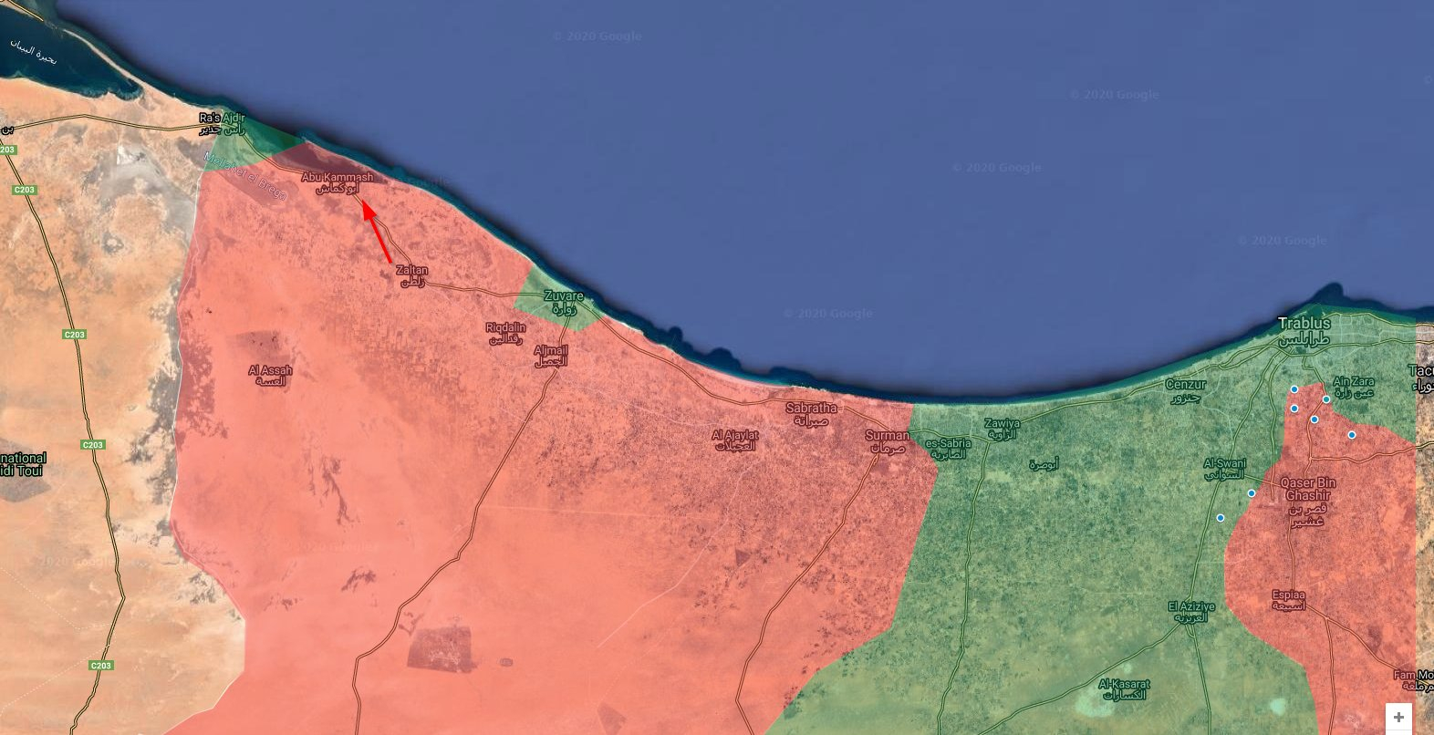
Najnowsza mapka zdobyczy terytorialnych podczas kontr-natarcia Rządu Porozumienia Narodowego na froncie w okolicach Syrty.
Linia czerwona to była linia frontu.
A linia zielona to zdobycze terytorialne GNA.
#libia #afryka #mapa #mapporn #konfliktynaswiecie
Linia czerwona to była linia frontu.
A linia zielona to zdobycze terytorialne GNA.
#libia #afryka #mapa #mapporn #konfliktynaswiecie


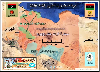
Jednostki Jemeńskie nie wytrzymały natarcia oddziałów Ansar Allah ale przegrupowały się i próbowały okrążyć nacierające wojska Houthi.
Sytuacja z rana 27 Marca 2020.
Będzie sporo wiadomości z Jemenu ale to za chwile.
#jemen #arabiasaudyjska #mapa #mapporn #bliskiwschod #konfliktynaswiecie
źródło: comment_1585330703s4QFAEPxciyppZBsNtvOVN.jpg
Pobierz